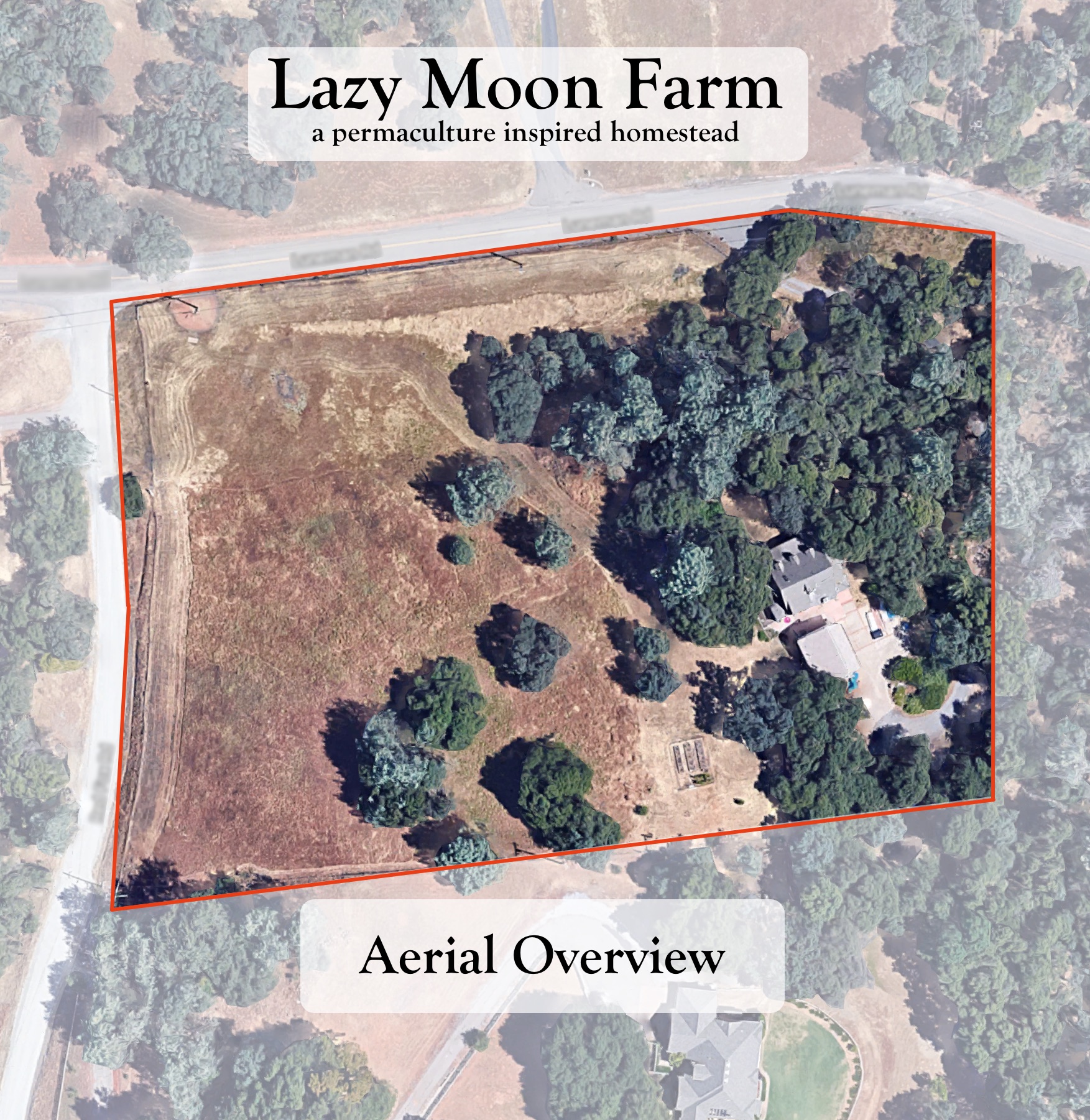

One of the things I’ve heard over and over again is that you should really spend a year on your property before you start making significant changes. Somehow I really doubt that we are going to make it that year, but I feel that the next best thing is to try to understand the property best we can. I’ve been working on that in two different ways, first I’ve been string trimming the area around the house, learning the contours of the hills, the pockets of heavier growth, the areas of rock, et cetera. The trimming has really allowed me to slowly walk this part of the property and become much more familiar with it than if I had mowed it with a ride on or just hiked through it. The second way is we are starting to map the property so that we can really plan what we want to do.
The Blog Tenth Acre Farm has a really great write-up on the 6 Maps to Draw for the Permaculture Farm Design. In their blog post they outline six maps they feel that help to best evaluate the property and plan properly. We are going to work up the maps as best we can, and use them to build our master plan map so we can prep the ground for a major planting next winter/spring.
As I started to create our maps I came across a couple of tools that I found really helpful and wanted to share for anyone else looking to create their own maps. First, Google Earth has great tools for basic measuring like linear and square footage, but also slope and elevation gain/loss. I will assume that the numbers are slightly off but for a free, easy to use tool it is amazing.
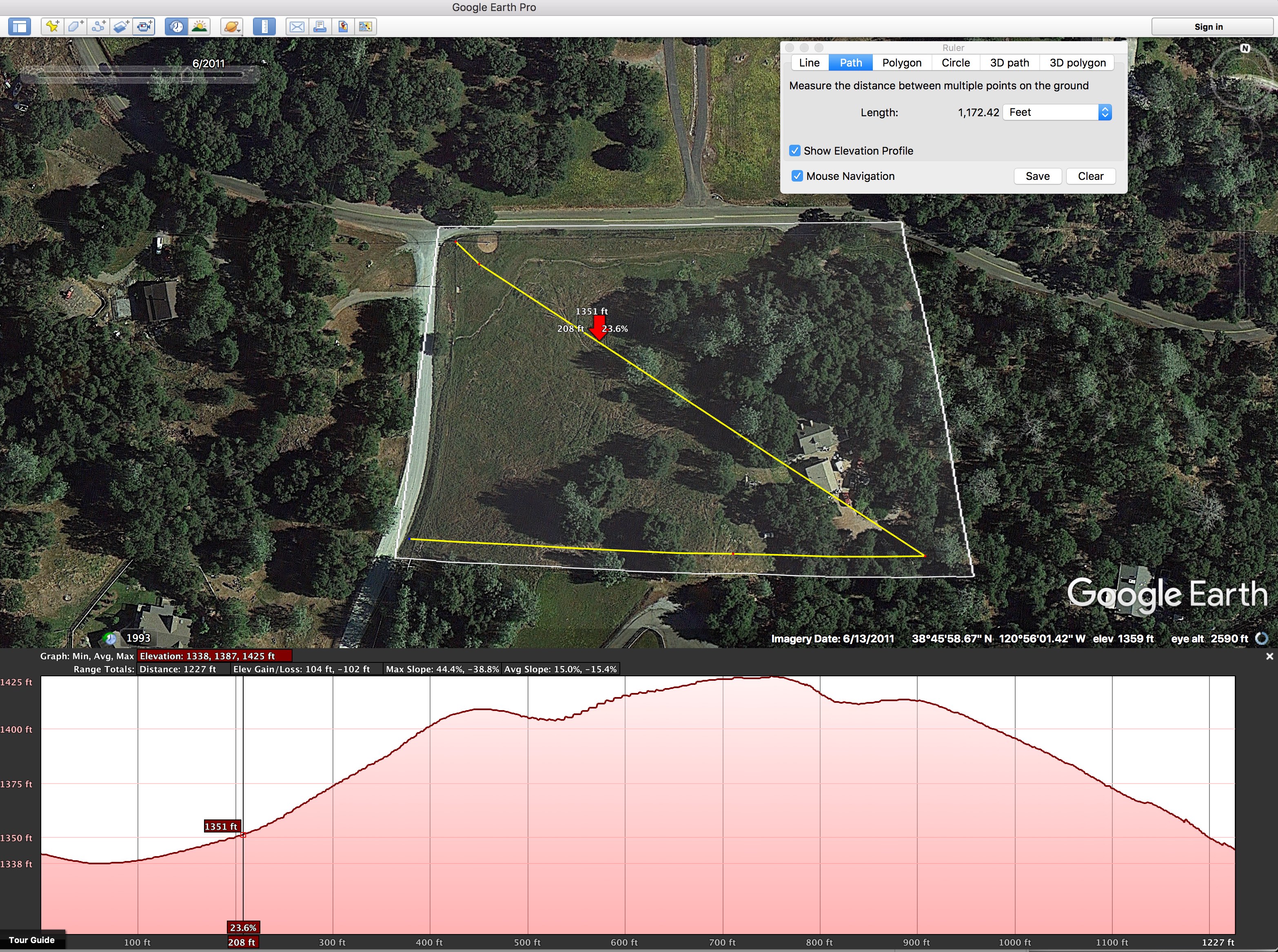
Also I found a great video tutorial on how to create a topographic map using Sketch Up and Google’s terrain data. The tutorial used a five foot contour for its map but when I started working our maps I found a two and half-foot measurement much more descriptive for our five acre property.
So now I need to get back to finishing up our actual maps. I’m hoping to get the information ones done this week, and then we will use them to create our master plan which will likely go through many iterations until we agree on where our homestead is headed.